


A structural look at how terrain, corridors and infrastructure shape every run.
What This Is
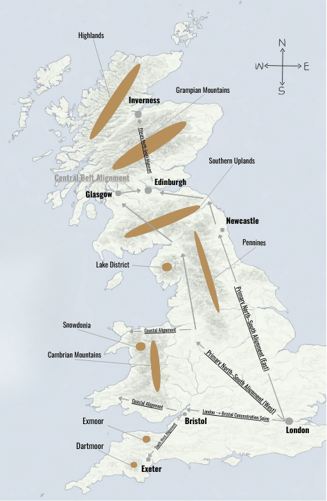
This document explains how Britain’s road network is formed.
It focuses on terrain, settlement patterns and historic infrastructure, not route planning and not driving instruction.
It looks at the structure beneath the road.
Why It Matters to Drivers
Most drivers have felt it:
• Some corridors consistently feel stable and controlled.
• Some cross-country routes always seem to compress decision-making.
• Certain areas repeatedly create friction, even when distance looks reasonable.
• Motorway spines often follow older patterns of movement.
This guide helps make sense of those patterns.
It won’t tell you which road to take.
It will help you understand why the network behaves the way it does.
Who It’s For
This is for drivers who want to understand the structure beneath the road, not just react to it.
If you’ve ever wondered why certain runs feel easier than others, even when they’re longer, this will likely resonate.
Download the PDF
Enter your email below and the guide will be sent directly to your inbox.
Take your time with it. It’s designed to be read calmly, not rushed.